
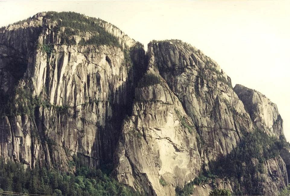
The Stawamus Chief (often referred to as simply The Chief, or erroneously as the Squamish Chief) is a granite dome located adjacent to the town of Squamish, British Columbia. It towers over 700 m (2,297 ft) above the waters of nearby Howe Sound. It is often claimed to be the "second largest granite monolith in the world." The Sḵwxwú7mesh, indigenous people from this area, consider the Chief to be a place of spiritual significance. The mountain gets its name from their village near its foot, St'a7mes (Stawamus).
The park
In 1997, the Stawamus Chief Provincial Park was established by the British Columbia Ministry of the Environment. The park is over 5 square kilometres in area and encompasses not only the Chief but also the Stawamus Squaw, a slightly smaller granitic dome located a short distance to the north-east. This was renamed Slhanay in 2009 due to the derogatory implications of the word "Squaw". Also featured in the park are a walk-in campground and a number of maintained hiking trails which lead through the forest of the Chief's "backside" to several summit areas.
In the spring of 2009, a new pedestrian bridge was opened across the highway. It provides access to the park from a new southbound parking lot in addition to linking the climbing areas of The Chief with those on the granite faces of Malamute Bluffs. This bridge was built as part of the Winter Olympic upgrades of the Sea to Sky Highway.

Geology
The Chief is part of a medium-sized pluton of a granitic rock (granodiorite) that was initially formed in the early Cretaceous (approximately 100 million years ago) by the slow cooling and solidification of molten magma deep below the surface of the Earth. Exhumation of the granite body probably occurred mostly by erosion of overlying rocks over tens of millions of years, with glacial erosion processes dominating exhumation over the last 2.5 million years. Once exposed at the surface, the original granite body was shaped by glacial erosion, which is responsible for the tall steep walls that define the Chief, as well as the excavation of Howe Sound, a fjord. Classic hallmarks of glacial erosion are ubiquitous, especially polished, striated surfaces. Polish and striations observable at the very summit of the formation require that, at the peak of glaciation, the entire formation was buried under a substantial thickness of ice.
The striking gullies that separate and define the three summits of the Chief are the result of fracturing and mass-wasting of large blocks along a series of vertical, and roughly north-south oriented deep seated fracture sets (joints).
The Chief may be the root of an extinct volcano because no volcanic activity has occurred in the Squamish area from about 86 million years ago to the beginning of Garibaldi Volcanic Belt volcanism about 2-3 million years ago. In the Squamish area, Garibaldi Volcanic Belt volcanism ceased during or shorty after the end of the last ice age.


0 comments:
Post a Comment