Friday, August 26, 2011

Mount Thor

Mount Thor, officially gazetted as Thor Peak, is a mountain with an elevation of 1,675 m (5,495 ft) located in Auyuittuq National Park, on Baffin Island, Nunavut, Canada. The mountain is located 46 km (29 mi) northeast of Pangnirtung and features the Earth's greatest purely vertical drop at 1,250 m (4,101 ft), with an average angle of 105 degrees. This feature makes the site popular with climbers, despite its remoteness. Camping is allowed, with the only official site being at the entrance to the Akshayuk Valley near Overlord Peak.


Mount Thor is part of the Baffin Mountains which in turn form part of the Arctic Cordillera mountain range. The mountain is made of granite and is the most famous of Canada's mountains named "Thor".


Mount Thor was first climbed in 1953 by an Arctic Institute of North America team. The team members were Hans Weber, J Rothlisberger and F. Schwarzenbach. The same men climbed the North Tower of Mount Asgard for the first time.

The world record for longest rappel was set on Mount Thor, July 23, 2006, by an American team consisting of: Chuck Constable, Dirk Siron, Ben Holley, Kenneth Waite, Gordon Rosser, Donny Opperman, Deldon Barfuss, and Tim Hudson. A 26-year-old Canadian national park warden, Philip Robinson, also rappelled, but had a problem with his equipment and was killed when he dropped to the base of the mountain. There had been a previous attempt in 2004, but they returned without rappelling due to dangerous weather conditions.


Monday, August 22, 2011

Piz Badile

Piz Badile (3,308 m) is a mountain in the Bregaglia range in the Swiss canton of Graubünden and Italy, the border between the two countries running along the summit ridge. Its northeast face is considered one of the six great north faces of the Alps.

The first ascent of Piz Badile was by W. A. B. Coolidge with guides F. and H. Dévouassoud on 27 July 1867 by the south ridge. The mountain had first come to the notice of British alpinists from D. W. Freshfield's writings of the 1860s. He gave the name 'the Grey Twins' to Piz Badile and Piz Cengalo, and made the first ascent of Piz Cengalo in 1866.


The two classic routes on Piz Badile are the north ridge and the Cassin Route on the north-east face. The north ridge – the Badilekante – was first prospected solo by the Swiss guide Christian Klucker in 1892 (Klucker later made the first ascent of the Badile's west-south-west ridge with Anton von Rydzewski and M. Barbaria on 14 June 1897). After several unsuccessful attempts by Italian parties in 1911, the ridge (IV, one pitch of V-) finally fell to Alfred Zürcher with the guide Walter Risch on 4 August 1923. F. l'Orsa and André Roch found a more direct line on the ridge on the second ascent (18 July 1926).


The most popular route on the north-east face is the Cassin Route (V+/A0 or VI+), so-called after the first ascentionist Riccardo Cassin, who climbed it with V. Ratti and G. Esposito, together with the Como team of Mario Molteni and Giuseppe Valsecchi on 14–16 July 1937. Molteni and Valsecchi were already on the face when Cassin and his party started out, but the climbers subsequently joined forces. In this famous alpine epic, Molteni died of exhaustion and exposure on the summit, whilst Valsecchi died on the descent by the south ridge just before reaching the hut.

The name Badile means spade or shovel (arising from the mountain's appearance when viewed from the Val Bregaglia).


Aiguille du Dru

The Aiguille du Dru (also the Dru or the Drus; French, Les Drus) is a mountain in the Mont Blanc massif in the French Alps, lying to the east of the village of Les Praz in the Chamonix valley.

The mountain has two summits:

  • Grande Aiguille du Dru (or the Grand Dru) 3,754 m, and
  • Petite Aiguille du Dru (or the Petit Dru) 3,733 m.

The two summits are located on the west ridge of the Aiguille Verte (4,122 m) and are connected to each other by the Brèche du Dru (3,697 m). The north face of the Petit Dru is considered one of the six great north faces of the Alps.


Ascents

The first ascent of the Grand Dru was by British alpinists Clinton Thomas Dent and James Walker Hartley, with guides Alexander Burgener and K. Maurer, who climbed it via the south-east face on 12 September 1878. Dent describes the scene upon reaching the top:
Our first care was to level the telescope in the direction of Couttet's hotel. There was not much excitement there, but in front of the Imperial [Hotel] we were pleased to think we saw someone looking in our direction. Accordingly with much pomp and ceremony the stick (which I may here state was borrowed without leave) was fixed up. Then to my horror Alexander produced from a concealed pocket a piece of scarlet flannel like unto a baby's undergarment, and tied it on. I protested in vain. In a moment the objectionable rag was floating proudly in the breeze.
The Petit Dru was climbed in the following year, on 29 August 1879, by J. E. Charlet-Straton, P. Payot and F. Follignet via the south face and the south-west ridge. The first traverse of both summits of the Drus was by E. Fontaine and J. Ravanel on 23 August 1901. The first winter traverse of the Drus was by Armand Charlet and Camille Devouassoux on 25 February 1938.

In 1889 both peaks of the Dru were climbed for the first time from the Petit Dru to the Grand Dru by two parties. One party contained Miss Katherine Richardson and guides Emile Rey and Jean-Baptiste Bich, and the other Mr Nash and Mr Williams with guides François Simond, Frederic Payot and Edouard Cupelin.


The west face

This 1000 m-high rock face has seen serious rockfalls in 1997, 2003 and 2005, which have considerably affected the structure of the mountain and destroyed a number of routes. Although at the time of the first ascent of the north face (Pierre Allain and R. Leininger on 1 August 1935), Pierre Allain considered the west face to be unclimbable, the team of A. Dagory, Guido Magnone, Lucien Bérardini and Mr. Lainé succeeded on the face in a series of attempts on July 5 and 17–19 July 1952 using considerable artificial aid. From 17–22 August 1955, the Italian climber Walter Bonatti climbed a difficult solo route on the south-west pillar of the Petit Dru (the Bonatti Pillar); this route – like many on the west face – no longer exists in its original state owing to rockfall, the scars of which remain clearly visible from the Chamonix valley. Seven years later, from 24–26 July 1962, Gary Hemming and Royal Robbins climbed the 'American Direct', a more direct route up the west face than that taken in 1952. On 10–13 August 1965, Royal Robbins, this time accompanied by John Harlin, climbed the 'American Direttissima'.


Summit statue

On 4 September 1913 a party of climbers led by Camille Simond and Roberts Charlet-Straton attempted to carry a hollow metal statue of Our Lady of Lourdes up the peak. The statue, almost a metre high, weighing 13 kilos and made of aluminium, had to be left in a rocky crevice at 3,000 m because of poor weather, and it was only on 18 September 1919 that the statue was finally hoisted to the summit by a party from Argentière: Alfred, Arthur, Camille, Joseph, and Jules-Félicien Ravanel together with the village priest, abbé Alexis Couttin.


Tre Cime di Lavaredo

The Tre Cime di Lavaredo (Italian for "the three peaks of Lavaredo"), also called the Drei Zinnen (German, literally "three merlons"), are three distinctive battlement-like peaks, in the Sexten Dolomites of northeastern Italy. They are probably one of the best-known mountain groups in the Alps. The three peaks, from east to west, are:
  • Cima Piccola/Kleine Zinne ("little peak")
  • Cima Grande/Große Zinne ("big peak")
  • Cima Ovest/Westliche Zinne ("western peak").
The peaks are composed of well-layered dolostones of the Dolomia Principale (Hauptdolomit) formation, Carnian to Rhaetian in age, as are many other groups in the Dolomites (e.g., the Tofane, the Pelmo or the Cinque Torri).
Until 1919 the peaks formed part of the border between Italy and Austria. Now they lie on the border between the Italian provinces of South Tyrol and Belluno and still are a part of the linguistic boundary between German-speaking and Italian-speaking majorities. The Cima Grande has an elevation of 2,999 metres (9,839 ft). It stands between the Cima Piccola, at 2,857 metres (9,373 ft), and the Cima Ovest, at 2,973 metres (9,754 ft).


First ascents

The first ascent of the Cima Grande was on August 21, 1869, by Paul Grohmann with guides Franz Innerkofler and Peter Salcher. The Cima Ovest was first climbed exactly ten years later, on August 21, 1879, by Michel Innerkofler with G. Ploner, a tourist. The Cima Piccola was first climbed on July 25, 1881, by Michel and Hans Innerkofler. The routes of these three first ascents are still the normal ascent routes; the Cima Piccola's route is the most difficult of the three.

Emilio Comici was the first to climb the north face of the Cima Grande in 1933 in a party of three, after an ascent time of 3 days and 2 nights. This partly overhanging northern face is considered by climbers to be one of the great north faces of the Alps.


Tourism

Numerous routes lead from the surrounding communities to and around the peaks. The most common route is from Paternkofel/Monte Paterno to the alpine hut Auronzo at 2,333 m (7,654 ft), over Paternsattel (Patern Pass) to the alpine hut Dreizinnenhütte/Locatelli at 2,405 m (7,890 ft), and then to the peaks. There are a number of other routes as well.

Since the front line between Italy and Austria during World War I ran through these mountains, there are a number of fortifications, man-made caves, and commemorative plaques in the area.

Nearby communities include Auronzo di Cadore Toblach/Dobbiaco, Sexten/Sesto, and Pustertal.

The area has also staged many finishes in Giro D'Italia.

Friday, August 19, 2011

Great north faces of the Alps

The north face of the Eiger
In mountaineering, the six great north faces of the Alps (also called the six 'classic north faces') are known for their difficulty and great height. They are:

  • Cima Grande di Lavaredo
  • Eiger
  • Grandes Jorasses
  • Matterhorn
  • Petit Dru
  • Piz Badile

The north-east face of Piz Badile

Attaining the first ascent of each of these six faces was a major preoccupation of the best European climbers in the 1930s. Gaston Rébuffat, a Chamonix mountain guide and renowned French alpinist, was the first to successfully climb all six of these north faces. His 1954 work, Etoiles et Tempêtes (Starlight and Storm), chronicles these climbs.

The north face of Cima Grande di Lavaredo

Three of these north faces—the Eiger, the Matterhorn and the Grandes Jorasses—are considerably harder to climb than the other three. This led to their becoming known as 'the Trilogy'. The first to climb these three faces within a year was the Austrian Leo Schlömmer, from the summer of 1961 to the summer of 1962. Ivano Ghirardini was the first to climb the Trilogy in winter, solo (1977-78). With the introduction of the concept of enchainment, the race was on to climb all three faces in one outing, a race eventually won by Christophe Profit who achieved the feat between 11–12 March 1987 in a time of 24 hours.

The north face of the Grandes Jorasses

The north face of the Petit Dru (right) with the ice-field of 'the Niche' clearly visible

The north face of the Matterhorn (right, in shade)


Giewont

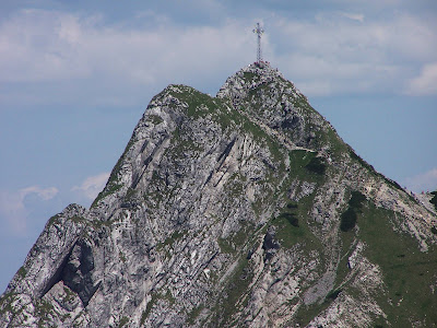
Giewont (pronounced Gyeh-vont) is a mountain massif in the Tatra Mountains of Poland, and is 1895 metres AMSL at its highest.

It comprises three peaks (all m/metres in AMSL):
  • Small Giewont - (Polish Mały Giewont, 1728 m)
  • Great Giewont - (Wielki Giewont, 1895 m)
  • Long Giewont - (Długi Giewont, 1867 m).

There is a mountain pass located between Great and Long Giewont, known as Szczerba (1823 m). It is located between the valleys (doliny) of Kondratowa, Małej Łąki and Strążyska. Long Giewont and Great Giewont are situated at a higher altitude than the nearby town of Zakopane, making them clearly visible from that city.

On Great Giewont, there is a 15 m steel cross that is the site of many religious pilgrimages. Unfortunately, the area is also notorious for its hazardous nature during thunderstorms, so this should be taken into consideration when traveling to that location.


Geologically, Giewont is composed of dolomite and limestone caves, as well as gneiss and granite in the southern section.

The first recorded ascent to Giewont's summit was undertaken in 1830 by Franciszek Herbich and Aleksander Zawadzki (the 19th century explorer, not the 20th century communist). The first winter ascent of Giewont occurred in 1904 by a group of five mountaineers led by Mariusz Zaruski.


Giewont lies in the area of the Polish Tatra National Park (Tatrzański Park Narodowy). In Polish folklore it is associated with a legend about oversleeping knights, who will awake when Poland is in danger. The profile of the mountains is similar to a lying knight, wherein the Long Giewont is the knight's torso, and the Great Giewont is the knight's face as viewed from the side (the three 'peaks' being the chin, the nose, and the eyebrow). The image of Giewont as viewed from the south (see below) makes the profile easy to discern.


Thursday, August 18, 2011

Kjerag

Kjerag or Kiragg is a Norwegian mountain, located in Lysefjorden, in Forsand municipality, Ryfylke, Rogaland. Its highest point is 1110 m above sea level, but its northern drop to Lysefjorden attracts most visitors. The drop is 984 m (3,228 ft) and is just by the famous Kjeragbolten, a 5 m³ big stone which is plugged between two rocks.

Kjerag is a popular hiking destination. Some go there because Preikestolen has become too crowded, some to jump onto Kjeragbolten and quite a lot of BASE jumpers from all over the world go there to dive off the high cliffs. Kjerag is also a popular climbing destination, with many difficult routes going up its steep faces.


The easiest ascent starts from the visitors center Øygardsstølen, with a 2.5-3 hour rather strenuous walk each way. From Stavanger, it is roughly a 2 hour drive (closed in winter season). Or take the touristferry from Lauvvik to Lysebotn in summer. The Lyseroad up from Lysebotn is spectacular (closed in winter). The best season for walking is late June to September depending on snow conditions.


Kjeragbolten

Kjeragbolten, a 5 m³ boulder wedged in a mountain crevasse by the edge of the Kjerag mountain (59°2′0.83″N 6°35′32.79″E / 59.0335639°N 6.5924417°E / 59.0335639; 6.5924417). It is possible to walk onto the rock without any equipment, but there is a direct 241 m drop below and then another tumble of 735 m down to Lysefjorden, so to walk onto it requires good nerves and steady feet. The name means "Kjerag Boulder" or "Kjerag Bolt".


BASE jumping

Kjerag has become a popular BASE jumping destination. In the period 1994 to 2008 29,000 jumps were performed.

In this period there were ten fatal accidents. A list of jumpers who perished at Kjerag is provided below:
  • Sebastian Dectot (24, from France), August 16, 1996
  • Ulla-Stina Östberg (46, from Sweden), July 29, 1997
  • Thor Alex Kappfjell (32, from Norway), July 6, 1999
  • Kirill Goretov (29, from Russia), August 15, 1999
  • Terry Forrestal (52, from United Kingdom), June 10, 2000
  • Valentino Ventori (30, from Italy), August 5, 2000
  • Lori Barr (37, from USA), July 23, 2002
  • Rob Tompkins (30, from USA), September 12, 2002
  • Darcy Zoitsas (nickname Peter Pan) (39, from Australia), July 19, 2005
  • Anton Knestyapin (25, from Russia), July 25, 2010
In the Norwegian documentary film Loop, Kristen Reagan climbs up the 1000 meter drop before BASE jumping off the same cliff.


The name

The name is possibly a compound of kje 'kid' and ragg 'goat's hair, shag'. The rough surface of the mountainside have then been compared with the shaggy hair of a kid goat.


Troll Wall

The Troll Wall (Norwegian: Trollveggen) is part of the mountain massif Trolltindene (Troll Peaks) in the Romsdalen valley, near Åndalsnes and Molde, on the Norwegian west coast. Trollveggen is part of the Reinheimen National Park in the municipality of Rauma in Møre og Romsdal county. The Troll Wall is the tallest vertical rock face in Europe, about 1,100 metres (3,600 ft) from its base to the summit of its highest point. At its steepest, the summit ridge overhangs the base of the wall by nearly 50 metres (160 ft). The Rauma River and the European Route E136 runs just to the east of the wall.

The rock is gneiss, formed into a broken rock wall of huge corners, concave roofs, and crack systems, topped with a series of spires and pinnacles on the summit rim. The rock is generally loose, and rockfall is the norm on this north-facing big wall. There was a series of large rockfalls on the wall in September 1998, radically changing the character of several climbing routes.

The Troll Wall has been a prestigious goal for climbers and BASE jumpers alike. In 1984, Carl Boenish, the "father" of BASE jumping, was killed on the Troll Wall shortly after setting the world record for the highest BASE jump in history. BASE jumping from Troll Wall has been illegal since 1986.


Climbing history

The Troll Wall was first climbed in 1965 by a Norwegian team. The Norwegian team, consisting of Ole Daniel Enersen, Leif Norman Patterson, Odd Eliassen, and Jon Teigland, finished one day ahead of the British climbers Tony Howard, John Amatt and Bill Tweedale, who established the most popular climbing route on the wall, the Rimmon Route. As of 2003, this route was reported unclimbable because a rockfall in September 1998 destroyed five of its pitches.

The wall saw its first winter ascent in March 1974, when a Polish team spent 13 days repeating the 1967 French Route. In 1979, the wall was free climbed for the first time by local climber Hans Christian Doseth and Ragnhild Amundsen.

Today, there are many routes on the wall, ranging in length and difficulty. The classic Rimmon and Swedish routes were normally free climbed in a day or two until being heavily damaged by the 1998 rock falls. The longer and more engaging aid routes, such as the 1972 test piece Arch Wall (climbed by Ed and Hugh Drummond in 20 days), or the 1986 Death to All/Pretty Blond Vikings, which cuts through the steepest part of the wall, require advanced knowledge of big wall climbing and several days on the wall.

Due to the serious character of the wall, in addition to a cold and damp climate, new routes on Troll Wall are rare. The most recent contribution is the Krasnojarsk Route, established by a Russian team during 19 days in February 2002.


Recent ascents

In July 2010, Arch Wall, previously a serious aid route of difficulty up to A4+, saw its first all-free ascent by local climber Sindre Sæther and his father, Ole Johan. Arch Wall is about 1,200 metres (3,900 ft) of climbing over 37 pitches, and it took the two a total of 36 hours of climbing to reach the summit.


BASE Jumping

In 1980 a new sport appeared when the Finnish Jorma Öster made the first jump with parachute off the Troll Wall.

The Troll Wall has also gained notoriety as a favourite haunt of BASE jumpers. It was one of the sites where BASE jumping was pioneered in the eighties, until Norwegian authorities made BASE jumping from the Troll Wall illegal on July 25, 1986. Parachute equipment that wasn't adapted for jumping from cliffs, and the fact that the jumpers had to find exit points by a trial and error method meant many fatalities in a short period of time. However, by the use of wingsuits, jumpers can jump from Trollveggen's highest point and still make a safe landing.

It is often impossible to use helicopters to get deceased or injured jumpers down from the wall, meaning rescuers have to climb the wall at great risk. Despite the fact that BASE jumpers face heavy fines and loss of parachute equipment if caught, and that the wall still claims lives, the Troll Wall continues to be popular both with local jumpers and foreigners. Eight BASE jumpers have lost their lives in Trollveggen. Carl Boenish was the first, and the last fatality was in 2008.


Friday, August 12, 2011

Snake Island (Black Sea)

Snake Island, also known as Serpent Island, (Ukrainian: Острів Зміїний, Ostriv Zmiinyi; Romanian: Insula şerpilor), is a Ukrainian island located in the Black Sea near the Danube Delta.

The island is populated. A rural settlement of Bile was established in February 2007, which is part of the Vylkove city, Kiliya Raion, Odessa Oblast. The territorial limits of the continental shelf around Snake Island were delineated by the International Court of Justice.


Geography

The island is an igneous rock formation located 35 km from the coast, east of the mouth of the Danube River. The island's coordinates are 45°15′18″N 30°12′15″E / 45.255°N 30.20417°E / 45.255; 30.20417. The island is X-shaped, from S-W to N-E 690 meters by 682 meters from N-W to S-E, covering an area of 0.205 km². The highest area is 41 metres (135 ft) above sea level. The island does not have a prominently featured mountain, but rather a low-slope hill.

The nearest coast location to Snake Island is Kubanskyi Island on the Ukrainian part of the Danube Delta, located 35 km (22 mi) away between the Bystroe Channel and Skhidnyi Channel. The closest Romanian coast city, Sulina is 45 km (28 mi) away. The closest Ukrainian city is Vylkove, 50 km (31 mi), however there also is a port Ust-Dunaisk, 44 km (27 mi) away from the island.

In the coastal waters 50 fish and six crab species have been recorded, some of which are included in the Red Book of Ukraine. A presidential decree of 9 December 1998, Number 1341/98, declared the island and coastal waters as a state protected area. The total area protected covers 232 hectares.


Maritime delimitation

The status of Snake Island was important for delimitation of continental shelf and exclusive economic zones between the two countries. If Snake Island were recognized as an island, then continental shelf around it should be considered as Ukrainian water. If Snake Island were not an island, but a cliff, then in accordance with international law the maritime boundary between Romania and Ukraine should be drawn without taking into consideration the isle location.

On 16 September 2004 the Romanian side brought a case against Ukraine to the International Court of Justice in a dispute concerning the maritime boundary between the two States in the Black Sea.

On February 3, 2009, the court delivered its judgment, which divided the sea area of the Black Sea along a line which was between the claims of each country. The court concluded that Snake Island is not an island, therefore it "should have no effect on the delimitation in this case, other than that stemming from the role of the 12-nautical-mile arc of its territorial sea".


White Cliffs of Dover

The White Cliffs of Dover are cliffs which form part of the British coastline facing the Strait of Dover and France. The cliffs are part of the North Downs formation. The cliff face, which reaches up to 107 metres (351 ft), owes its striking façade to its composition of chalk (pure white calcium carbonate) accentuated by streaks of black flint. The cliffs spread east and west from the town of Dover in the county of Kent, an ancient and still important English port.

The cliffs have great symbolic value for Britain because they face towards Continental Europe across the narrowest part of the English Channel, where invasions have historically threatened and against which the cliffs form a symbolic guard. Because crossing at Dover was the primary route to the continent before air travel, the white line of cliffs also formed the first or last sight of the UK for travellers.


Location

The cliffs are located along the coastline between approximately: Latitude 51°06'N, Longitude 1°14'E and Latitude 51°12'N, Longitude 1°24'E. Shakespeare Cliff marks the point where Great Britain most closely approaches continental Europe. On a clear day, the cliffs are easily visible from the French coast.


Geology

The cliffs are composed mainly of soft, white chalk with a very fine-grained texture, composed primarily of coccoliths, plates of calcium carbonate formed by coccolithophores, single-celled planktonic algae whose skeletal remains sank to the bottom of the ocean and, together with the remains of bottom-living creatures, formed sediments. Flint and quartz are also found in the chalk.

White cliffs like those of Dover (but smaller) are also found on the Danish islands of Møn and Langeland or the coasts of the island of Rügen in Germany. The cliff face continues to weather at an average rate of 1 centimetre (0.39 in) per year, although occasionally large pieces will fall. This most recently occurred in 2001, when a large chunk of the edge, as large as a football pitch, fell into the channel. Visitors are, therefore, urged to remain well away from the cliff edge.


Ecology

Several species of cliff nesting birds nest on the cliff face, including fulmar and colonies of Black-legged Kittiwake. However, contrary to the words of the famous song ("There'll be bluebirds over the white cliffs of Dover"), bluebirds are an American species not found in the UK.


Sunday, August 7, 2011

Møns Klint

Møns Klint, English: the Cliffs of Møn, is a striking landmark and tourist attraction along the eastern coast of the Danish island of Møn in the Baltic Sea. The bright chalk cliffs stretch some 6 km from the park of Liselund in the north to the lighthouse in the south. Some of the cliffs fall a sheer 120 m to the sea below. The area around Møns Klint consists of woodlands, pastures, ponds and steep hills, including Aborrebjerg which, with a height of 143 m, is one of the highest points in Denmark. The cliffs and adjacent park are now protected as a nature reserve. Møns Klint is popular with tourists from across Europe with some 250,000 visitors a year. There are clearly marked paths for walkers, riders and cyclists. The path along the cliff tops provides impressive views and leads to steps down to the shore in several locations.


On 29 May 2007, close to the cliff tops, the GeoCenter Møns Klint was opened by Queen Margrethe. The geological museum with interactive computer displays and a variety of attractions for children traces the geological prehistory of Denmark and the formation of the chalk cliffs. The museum was designed by PLH Architects, the winners of an international design competition.


Geology

The chalk forming the cliffs consists of the remains of shells from millions of microscopic creatures (coccolithophores) which lived on the seabed over 70 million years ago. As a result of huge pressure from glaciers moving west, the terrain was compacted and pushed upwards, forming a number of hills and folds. When the ice melted at the end of the last ice age about 11,000 years ago, the cliffs emerged. They form part of the same deposits as the cliffs of Rügen, Germany, on the other side of the Baltic. Today, it is possible to find fossils of various types of shellfish as the sea continues to erode the chalk. Erosion also caused one of the highest points on the cliffs, the Sommerspir, to fall into the sea in 1998, and in January 2007, there was an even larger landslide around the Store Taler, in the northern part of the cliffs, creating a 300-m long peninsula of chalk and fallen trees stretching out into the sea below.


Nature

Because of the special nature of the chalky soil, there are many rare plants in the area, particularly several varieties of orchid which are at their best in early summer. In particular, the tall lady orchid (Orchis purpurea) grows under the staircases leading down to the beach. The chalk also provides a distinctive light green tint to the beech trees along the top of the cliffs, maintaining their spring hues throughout the summer season. In the hilly park which stretches a couple of kilometers inland, there are a number of ponds and marshes, many populated by trees. Several signposted circuits provide opportunities for walkers, riders and cyclists to discover the surroundings.

In recent years, the peregrine falcon, the fastest of all birds as it swoops down to its prey at 350 km/h, has been observed breeding on Møns Klint. And the extremely rare large blue butterfly (Maculinea arion) can also be found in the area.


Points of interest

Liselund Park, at the northern end of the cliffs, is an attractive combination of small houses, ponds and rolling lawns built by Antoine de la Calmette for his wife Elisabeth or Lise at the end of the 18th century.

Klintholm Estate, Danish: Klintholm Gods, to the west of the wooded area along the cliffs, is a collection of old farm buildings dating back to 1780 and a large park. The manor house which used to form part of the estate was demolished in 2000 as a result of dry rot.


Access

Møns Klint can be reached by road either directly from Stege or from Klintholm Havn. In the summer, there is a regular bus service. Accommodation is available within the cliff area itself or in hotels and pensions in the vicinity. There is a camping site close to the main entrance to the park and a youth hostel nearby.


Møns Klint in art

Møns Klint has been a popular subject for landscape painters, especially during the Danish Golden Age when the national romanticism movement encouraged artists to take renewed interest in the Danish countryside. A few examples are shown below.